Welcome to my blog!


This is blog is about me dabbling with a little bit of everything, and not being particularly good at anything. And about the places I've been either on vacation or SAG:ing my husbands bicycle trips.


You can click on the pictures to make them bigger and/or click on the links to open another window for more info.

Monday, May 14, 2012

Blue Ridge Parkway Trip - Day 9

Saturday, May 12, 2012

Traveled from milepost 431.4 to the end at milepost 469.1

We wanted to leave fairly early since Mark, Jeff and I had a long drive ahead of us today. We had  a nice  breakfast at the hotel and headed out to yesterday's ending point at the Richland Balsam Overlook. Yesterday was nice and sunny, today it was overcast and cloudy, but at least it didn't rain. The overlook was in the clouds and most of the ride was too.

Sunrise at the Mount Pisgah Inn

Cherry Cove Overlook

Richland Balsam Overlook, in the clouds

Jeff ready for the last day on the parkway

Joe, Jeff and Mark ready to go again


Karen and I stopped at Waterrock Knob where on a clear day you can see the Great Smokey Mountains and 4 states. Today we could barely see our hands in-front of us, which made it an interesting drive, and even more interesting bike trip.


View of the 4 different states ;)


Driving in the clouds, well I was stopped to take this pic


We didn't want to stay in the higher elevations too long because it was cold and we also didn't want to be behind the guys while they were zooming down the hills. They said that there were several cars that could not get by them because they were going faster than what the cars were able to. Once we got lower down and were able to see something, we did stop at couple places but wanted to get to the end point before them. We found a Visitor's Center with restrooms in Cherokee N.C. where they could change and clean up a little bit before heading home.

Ballhoot Scar Overlook

Blue Ridge Parkway at the Ballhoot Scar Overlook

At the Cherokee N.C. Visitor Center

Cherokee N.C.

Cherokee N.C.

Cherokee N.C.


We then headed back to the end point and didn't have to wait too long before they arrived. After the required picture taking we loaded the cars and headed to the Visitor Center. We said goodby to Joe and Karen who went home to Georgia. Jeff and I drove with Mark 10 hours to his home in Braddock Heights in Maryland. We stayed overnight at his home.

Oconaluftee River

Oconaluftee River

Southern end of Blue Ridge Parkway


They did it!!!

Packing up

Almost ready to go

there is a little dog riding a motocycle, "mountain man" on the way

I-40

Mark having lunch at Sonic

Blue Ridge Mountains on the background as seen from I-81, we were there


This is how I spent some of the 10 hour drive


Blue Ridge Parkway Trip - Day 8

Friday, May 11, 2012

Traveled from milepost 376.7 to 431.4

Another beautiful sunny day, not too hot, not too cold. After breakfast at the hotel Karen and I dropped the guys off at yesterday's ending point at the Tanbark Overlook. They headed off before us, but we ended up at the Folk Art Center at the same time. It takes them a bit longer to climb those hills, but they are fast going down. There is a 45 mile/hour speed limit on the parkway, but usually we couldn't drive more than 30-40 miles an hour due to the curvy roads or fog/rain or some other reason.


Thumbs up again from everybody

Ready to go again


Karen and I were thinking of going to the Biltmore House, estate of George Vanderbilt, but first of all it was a bit pricey and would have taken the whole day if not more. We just wanted to see the house, but they didn't sell tickets just to see the house. You had to see everything, the gardens, the winery etc. We figured that we'd rather go to the Folk Art Center. Not only were they selling things, they also had a museum sort of thing and an art gallery and demonstrations, like weaving and broom making, at least today. I ended up buying couple of smaller things, but I also saw this bowl that I really liked. I left the center and got to my car and decided that I would kick myself if I didn't buy it since it was a one of a kind piece and I could never find another one like it. So I went back and bought it.

Folk Art Center

Folk Art Center


From there we were thinking of going to the North Carolina Arboretum, but thought that the guys could use a SAG stop so we went looking for them. They had passed the Arboretum exit by 10 miles by the time we found them. Instead of going there we went to our next hotel, which is the Pisgah Inn, right on the parkway. Before getting there we stopped at the Buck Springs Gap Overlook which had the ruins of George Vanderbilt's Mountain Hunting Cabin. While we were there the guys had passed us again and we saw them at the hotel. After checking in they kept going since they had decided to lengthen today so that our last day would not be so long and Mark, Jeff and I could head back home earlier.

View from Buck Springs Overlook


View from Buck Springs Overlook


Site of Vanderbilt's Hunting Cabin, tree on left is in old pictures

Site of Vanderbilt's Hunting Cabin

Site of Vanderbilt's Hunting Cabin


Buck Springs Overlook

Mount Pisgah Inn

They got here before we did


Karen and I stayed at the hotel and had a lovely lunch in their dining room. There are not that many places where you can eat along the parkway, so this was a real treat. I had the best turkey wrap ever, with Brie cheese and apples and other stuff. After lunch we headed up the road, had to go and pick up those guys, for some reason they did not want to ride the 20+ miles back to the hotel. We stopped at several overlooks. The views were just amazing and the pictures do not do them justice at all.

View from our room

View from our room

They are ready to head out again, Pisgah Inn

Mount Pisgah

Best lunch, turkey wrap, ever

Pounding Hill Overlook

Some kind of Azaleas growing on the side of the road

Caney Fork Overlook, elev. 5650' or 1722 meters

Haywood-Jackson Overlook, elev 6020' or 1834 m


We picked them up at the Richland Balsam Overlook which is the highest point right on the parkway. It is at milepost 431.4 and the elevation is 6050 feet or 1844 meters. We drove back to the hotel and after a shower and some rest we regrouped for a glass of wine and a nice dinner at the hotel. This is our last night on the parkway and tomorrow we are all heading home.

 
Jeff at Haywood-Jackson Overlook

Richland Balsam Overlook, highest point on parkway, 6053' or 1845m

View from Richland Balsam Overlook

Blue Ridge Parkway Trip - Day 7

Thursday, May 10, 2012

Traveled from milepost 292.7 to 376.7

Finally a day when it didn't rain. Today will be a very long one for the cyclists. They end up doing 94 miles (151km) and climbing over 10,000 ft (over 3km). They also climbed Mount Mitchell, which is the highest point east of Mississippi.

In the meantime Karen and I went to the  Moses H. Cone Memorial Park and Craft Center. Since we dropped the guys off early we had over an hour wait for the Craft Center to open. The day was not rainy, but it was cold and very windy. I ended up wearing couple of sweaters under my jacket. We decided to go and walk the Figure Eight Trail just to kill time. The Craft center had a lot of really beautiful arts and crafts and it was all very expensive too.

Off they go again, looks like thumbs up from everybody


Moses H. Cone Manor House

 
View from the Manor

Moses H. Cone Manor, from the side

Figure Eight Trail

Story of the Figure Eight Trail


Work being done at Moses H. Cone Manor fence

Some neat looking bottle cap and pull crafts @ Moses H. Cone

Julian Price Park Overlook


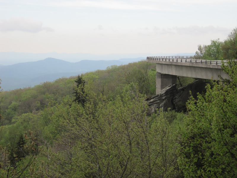
From there we headed south and stopped at the Linn Cove Viaduct and Visitor's Center. There was a trail to go under the viaduct to get a little bit different view of it.

Linn Cove Viaduct, milepost 304.4

Linn Cove Viaduct,


Linn Cove Viaduct, from underneath

Karen under the Linn Cove Viaduct

Linn Cove Viaduct, from underneath

Model of the building of the Linn Cove Viaduct

Karen under the Linn Cove Viaduct


About a mile or so before Crabtree Meadows we came across Mark who was just pulling over and it looked like he was having problems with his back wheel. Karen drove ahead to catch up with Joe and Jeff and let them know that we will be stopping at the next overlook and needing help fixing Mark's wheel. We loaded up Mark's bike and he got a lift to the Crabtree Meadows where Jeff changed his back wheel because his old one broke. It was a good thing that Jeff took the wheels off his old bike and brought them with us.

Changing Mark's back wheel

Karen and I at the Black Mountains Overlook

Black Mountains Overlook, milepost 342.3, elev. 3373' (1028m)

After that we caught them again at the Black Mountain Gap from where they took the road to the top of Mount Mitchell. Karen and I didn't bother driving up, instead we went to the Craggy Gardens Visitor Center. Contrary to it's name there are no gardens there. There was a fashion photo shoot though and we watched this poor girl freeze in skimpy dresses and sandals.

Jeff doing a no no, riding without holding the handlebars

Ready to tackle Mount Mitchell

Craggy Pinacle Tunnel, one of many

A photo shoot at Craggy Gardens Overlook

Photo Shoot at Craggy Gardens Overlook


We met the guys after their grueling ride at the Tanbark Overlook and from there took this really narrow and winding dirt road to north Asheville to our hotel. We stayed at Days Inn, which turned out to be quite nice for Day's Inn. Had dinner at the  Bellagio Bistro. They had a good selection of Italian and Greek food.

End of today's ride at Tanbark Overlook, no worse for wear. . .